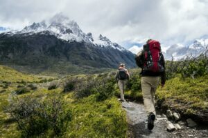
In an age where GPS devices and smartphone apps dominate navigation, the timeless skill of map reading continues to hold a special place, especially when exploring the vast and diverse landscapes of Canada. Whether you’re trekking through rugged terrain or embarking on a boating adventure, mastering the art of map reading is an essential skill that empowers you to navigate trails and waterways with confidence. In this article, we’ll delve into the importance of map reading and provide you with valuable insights to help you successfully navigate Canadian trails and water bodies.
Why Map Reading Matters
In the digital era, maps remain more than just pieces of paper – they are gateways to discovery and adventure. While technology can provide convenience, it’s essential to recognize the limitations it may have in remote areas with unreliable signals. By cultivating map reading skills, you become self-reliant, prepared for unexpected scenarios, and deeply connected to the landscape you’re exploring.
1. Choosing the Right Map
Before embarking on any journey, securing the appropriate map is paramount. For Canadian trails, National Topographic System (NTS) maps are the gold standard. These maps provide detailed topographical information, elevation contours, water features, and landmarks that are crucial for safe navigation. For waterways, nautical charts offer intricate details about coastlines, depths, and hazards.
2. Understanding Map Symbols
Maps are a visual language, and understanding their symbols is akin to deciphering a code. Key symbols represent features like trails, rivers, lakes, peaks, campsites, and more. Familiarizing yourself with these symbols ensures you interpret the map accurately, enabling you to recognize landmarks and identify potential obstacles.
3. Grasping Contour Lines
Contour lines on a topographic map depict elevation changes. By closely observing contour intervals, you can anticipate the steepness of slopes, locate valleys, and understand the overall terrain. Spaced closely, contour lines indicate steep ascents or descents, while spaced further apart suggest more gradual slopes.
4. Planning Your Route
A well-thought-out route can make your outdoor experience safer and more enjoyable. Study the map to identify key waypoints, such as junctions, water sources, and campsites. Plan your journey based on the terrain, distances, and elevation changes, taking into account your physical capabilities and the conditions.
5. Orienting the Map
Before you begin your trek or boating adventure, align your map with the actual landscape. A compass can help you orient the map to the north, allowing you to read it in relation to your surroundings accurately. This practice prevents confusion and ensures you’re moving in the right direction.
6. Tracking Progress and Making Adjustments
As you move along your trail or waterway, regularly compare your surroundings with the map. Note prominent features and landmarks to confirm your location. If you encounter obstacles or choose to explore alternate paths, adjust your route on the map accordingly.
In a world where technology often overshadows traditional navigation methods, the art of map reading remains a vital skill for adventurers. By learning to read and interpret maps effectively, you gain a sense of self-sufficiency, deepen your connection with nature, and enhance your outdoor experience in the Canadian wilderness. So, before your next journey through the diverse landscapes of Canada, embrace the map as your trusted guide – a timeless companion that reveals the hidden treasures of trails and waterways waiting to be explored.